Explore Cameroon
Overview of Cameroon
All Africa in One Country
Cameroon stands out for its extraordinary geographical, cultural, and human diversity. Located at the juncture of the Gulf of Guinea in Central Africa, it is often described as 'Africa in miniature' because so many of the continent’s landscapes and cultures are found within one country.

The Land
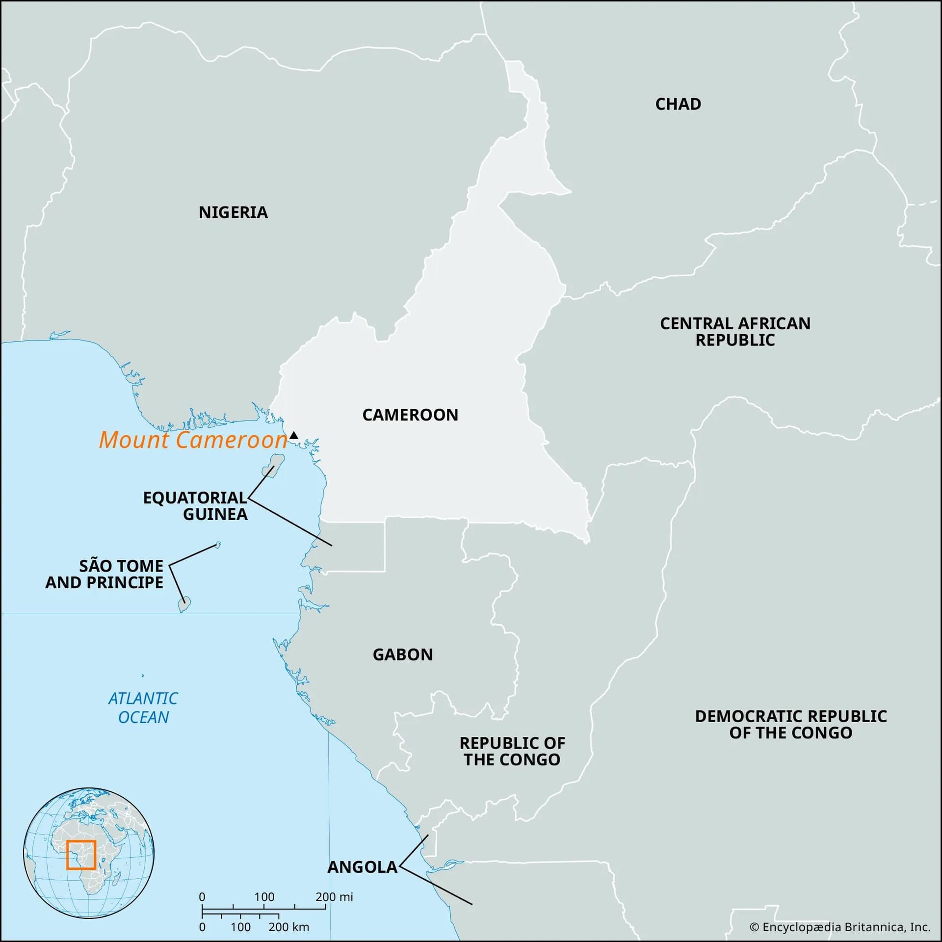
Cameroon is situated in Central Africa, bordered by Chad to the north, the Central African Republic to the east, Congo, Gabon and Equatorial Guinea to the south, and Nigeria to the west
Diversity
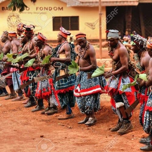
Cameroon has vast geographical diversity characterized by forest, savanna, mountains, and a population of over 240 ethnic groups.
Identity
Its unique mix of terrain, peoples, and cultures has led to Cameroon being called ‘Africa in miniature’ or ‘All Africa in one country’.
Explore Cameroon
The Land
Cameroon is situated in Central Africa, at the juncture of the Gulf of Guinea.
It is bound on the north by Chad, on the east by the Central African Republic, on the south by Congo, Gabon and Equatorial Guinea, and on the west by Nigeria.
Its strategic location and wide territorial diversity make it one of the most distinctive countries on the continent.
Explore Cameroon
All Africa in One Country
Cameroon has a vast geographical diversity characterized by forest, savanna, and mountains, alongside a population of over 240 ethnic groups.
Its diversity in terrain and culture has led to Cameroon being referred to as ‘Africa in miniature’ or ‘All Africa in one country’.
This remarkable variety gives visitors and residents alike the experience of many African landscapes and traditions within one nation.
Explore Cameroon
Topography
The physical geography of Cameroon is varied, with forests, mountains, large waterfalls, and deserts, and may be considered in four broad regions.
At the border of the northern Sahel region lies Lake Chad and the Chad Basin. Further south, the land forms a sloping plain rising to the Mandara Mountains.
The central region extends from the Benue River to the Sanaga River, with a plateau in the north. This area includes the Adamawa Plateau, which separates the agricultural south from the pastoral north.
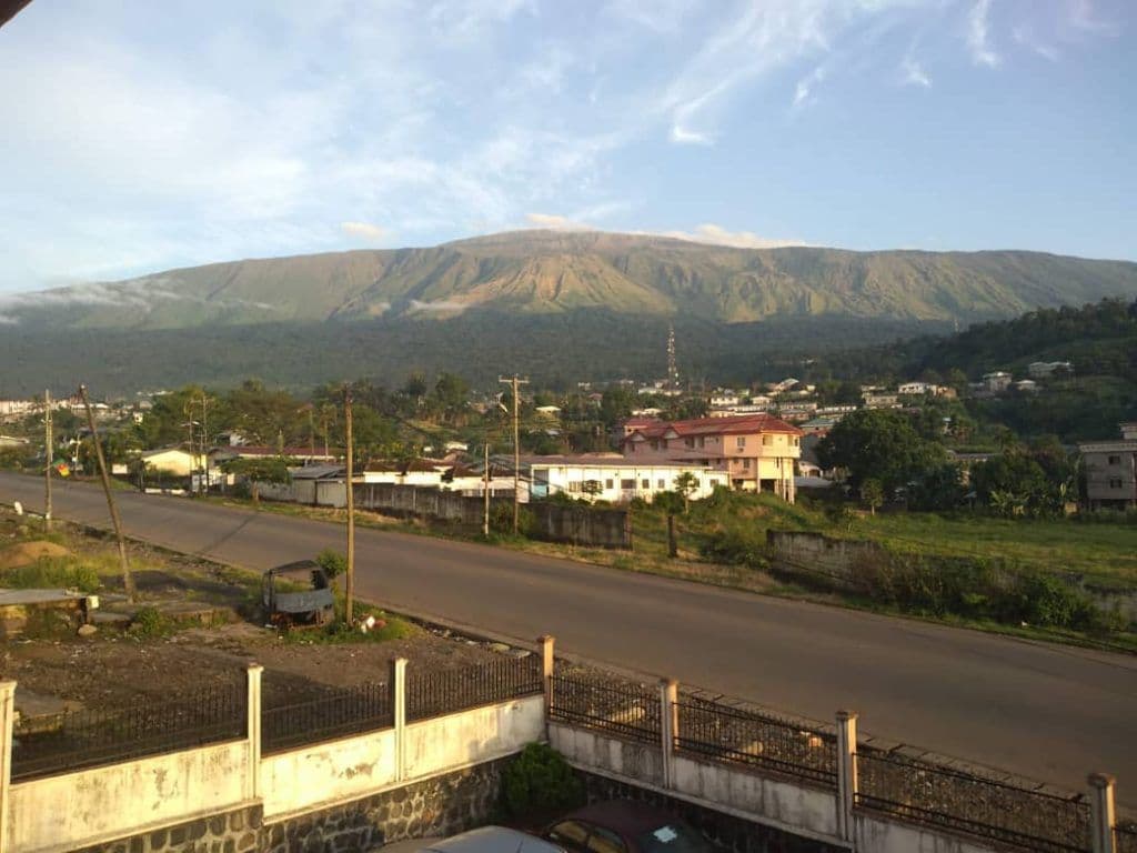
In the west, the land is mountainous, with a double chain of volcanic peaks rising to 4,095 metres at Mount Cameroon, the highest and wettest peak in western Africa.
To the south, extending from the Sanaga River to the southern border, lies a coastal plain and forested plateau.
Cameroon also has a complex drainage system: the Benue rises in the Mandara Mountains and later joins the Niger, while the Sanaga and Nyong flow into the Gulf of Guinea. The Dja and Sangha drain into the Congo Basin, and the Logone and Chari flow north into Lake Chad.
Contact Us
Would you like to learn more about Cameroon, its regions, or opportunities to visit and connect? Reach out through the High Commission contact page.